Map look
How the game draws your map: the size of the units, whether it scrolls around, what it shows on the territories, and a relief picture over it. Everything here goes into map.properties.
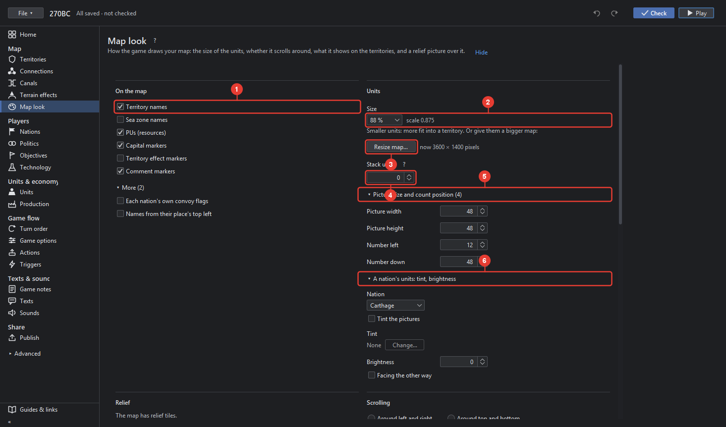
- On the map: what the game draws on every territory. Territory names, Sea zone names, PUs (resources), Capital markers, Territory effect markers, Comment markers. Under More: Each nation's own convoy flags, and Names from their place's top left for maps whose name places mark the top left corner instead of the middle.
- Units → Size: how big the game draws units, as a fraction of their pictures, for example scale 0.875. Smaller units: more fit into a territory. "Or give them a bigger map" leads to Resize map.
- Resize map… makes the whole map bigger or smaller. See Resize map below. The line beside it says the map's size now.
- Stack up to: how many units of a kind are drawn on top of each other; 0 for one with a number.
- Picture size and count position: Picture width and height of the unit pictures in pixels, 48 for the game's own; Number left and Number down, where the count is drawn from the picture's corner.
- A nation's units: tint, brightness: pick the Nation; Tint the pictures in a colour chosen with Change…; Brightness from −100, dark, to 100, light; Facing the other way mirrors the pictures.
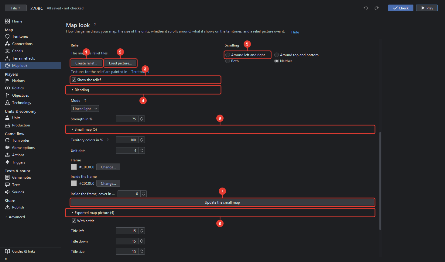
- Create relief… makes a relief from the outlines: coasts, waves and raised land, in a look
you choose. The relief is kept in
reliefTiles. - Load picture… takes a picture as big as the map as the relief; saving cuts it into reliefTiles. "Textures for the relief are painted in Territories ›" opens Territories, where Paint → Textures paints them.
- Show the relief is what the game does unless told not to (map.hasRelief).
- Blending: Mode and Strength in %, how the relief blends over the picture.
- Scrolling: whether the map goes on at the other side, Around left and right, Around top and bottom, Both or Neither.
- Small map: the map in the corner of the game. Territory colors in %, Unit dots size in pixels, the Frame colour and the colour Inside the frame with cover in %.
- Update the small map makes the small map's picture anew from the map's picture with its relief, written at once; the game fills the land in the owners' colours over it.
- Exported map picture: what a player's File → Export map picture writes: With a title, Title left, Title down, Title size and Title color.
- Mouse pointer: the map's own pointer is misc/cursor.gif; Point left and Point down are the point of it that clicks.
Resize map
From Map look or the map picture menu.
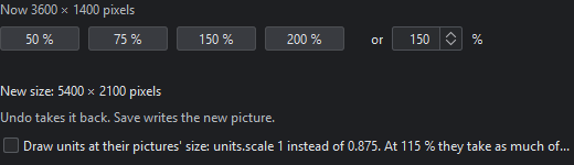
- Now shows the size.
- 50 %, 75 %, 150 %, 200 % are the usual sizes; or a value from 25 to 400 % typed in the field. New size says the result in pixels. A size that cannot be done says why and keeps Resize map off.
- Draw units at their pictures' size appears for a map whose units.scale is not 1: ticked, the resize sets units.scale to 1 and the suggested size keeps the units as big on the map as they are now.
- Resize map does it. The picture, the borders and every place are resized with it; units keep their size, so a bigger map gives them more room. Undo takes it back.
What happens:
- A saved map is resized tile by tile from its tiles on disk, never holding the whole picture, so any size works. A progress bar above the map and a spinner beside the button show it working; a big map takes a few minutes. The new tiles show at once; a save moves them into the map's folder and keeps the old ones aside, so an undo after the save still has them.
- A picture not saved yet is held whole, up to 50 million pixels: save first for a bigger size.
- A picture with lines drawn that are not saved yet asks for a save first, so the tiles have the lines.
- A map enlarged by an odd factor such as 120 % looks softer than before: a painted relief cannot be enlarged sharply by resampling. For the sharpest result enlarge the picture in an image editor and load it with Load another picture, or resize in whole steps.
- The message after the save ends with the map's new size.